Measuring the earth is a modern science. In addition to classic measuring tools, geodesists and geoinformatics specialists use modern satellite technology for remote sensing and positioning. They develop automatic, computer-assisted methods to collect, process, analyse and visualise spatial information.

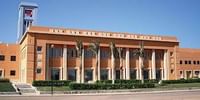
Leibniz University Of Hannover - [Uni-Hannover], Hannover, Lower Saxony - Courses & Fees
Hannover, Lower Saxony
University Public CollegeBachelor of Science [B.S] (Geodesy and Geoinformatics)
3 years
On Campus
German
Field of Study:
€432/Yr
€432 /Yr
Important Dates
| Event | Start Date |
| Application Opens For Summer Intake | Jan 15, 2024 |
| Application Opens For Winter Intake | May 31, 2024 |
Fees & Funding
Tution & Application Fees
| Year | Year 1 | Year 2 | Year 3 |
| Contribution Fees | €105 | €105 | €105 |
| Fees for Student Union | €20 | €20 | €20 |
| Semester Ticket | €250 | €250 | €250 |
| Administration Fees | €57 | €57 | €57 |
| Total Fees | €432 | €432 | €432 |
Eligibility & Entry Requirement
International applicants must provide a German language certificate. English B2 and German C1 certificate are required.
Ask your question
Similar Colleges You Might Be Interested In
- Similar Colleges

No Ratings Found!!
Follow

No Ratings Found!!
Follow

No Ratings Found!!
Follow
No Ratings Found!!
Follow

No Ratings Found!!
Follow
No Ratings Found!!
Follow
Students also visited

RWTH Aachen UniversityAachen, North Rhine-Westphalia

Free University of BerlinBerlin, Berlin

Technical University BerlinBerlin, Berlin

Ruhr University BochumBochum, North Rhine-Westphalia

University of BremenBremen, Bremen